Cape Cod Bay Monitoring Program
C I T I Z E N S C I E N C E
Welcome to the Future of Ecosystem Management
An initiative of the Provincetown Center for Coastal Studies
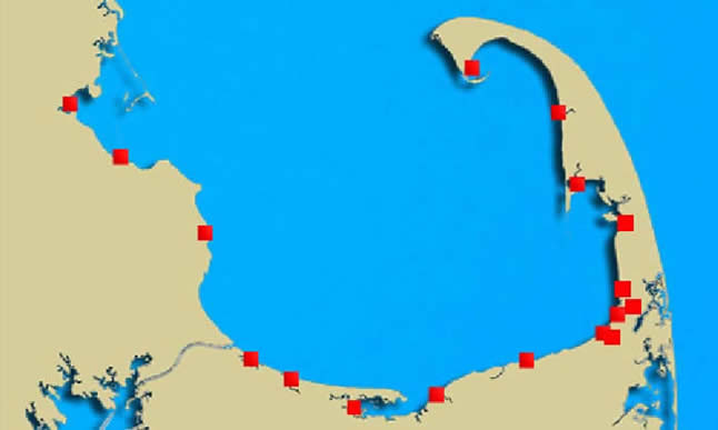
Monitoring Stations:
- Provincetown Harbor
- Pilgrim Lake/Pilgrim Lake
East - Pamet River - Herring River
- North Sunken Meadow
- Boat Meadow
- Cole Road Beach - Little Namskaket - Namskaket
- Upper Namskaket - Paines Creek - Grays Beach - Barnstable Harbor - Scorton Harbor - Upper Scorton Creek - Old Harbor (Sandwich) - Upper Old Harbor Creek - Ellisville Harbor - Plymouth - Jones River
- Sesuit Harbor
- Duck Creek (Wellfleet)
- Millway Beach
- Quivet Marsh
- References
Select a monitoring station from the list to the left or by clicking a location (box) on the map.
CONTACT