Geographic Location: 41 42.38 | 70 17.938
Current Volunteer Monitor: John Huss
Site Description:
Several years ago, this area, once known as the Pilgrim Lake system, was given back the name of East Harbor. Since the 1800s, this system has undergone many alterations, generated by both human and natural causes. Before it was Pilgrim Lake, it was East Harbor, a very sheltered harbor, connected to Cape Cod Bay by a 1,000 foot inlet. In 1868, a dike was built to clear a path for the railroad (now Route 6) which sealed the harbor from the bay. Thus, over time, this estuarine system turned fresh and was re-named Pilgrim Lake. For many years, tidal exchange has been limited to small diameter culverts and tide gates. As this system continued to degrade, the Cape Cod National Seashore began one of the largest coastal wetlands restoration projects ever. In 2002, steps were taken to re-introduce Cape Cod Bay into this system water via the culvert under Route 6. Since then, this system has slowly become more estuarine. For more information on this project see http://www.nps.gov/caco/naturescience/east-harbor-tidal-restoration-background.htm.
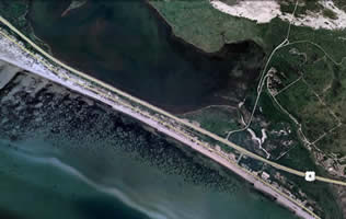
Samples for the Cape Cod Bay Monitoring Program are collected where the culvert from East Harbor drains into Cape Cod Bay.
|
|
|
|
Images:
|
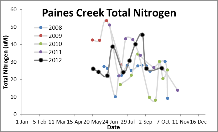
Water Quality Data: Pilgrim Lake 2006-2013: Vol_Pilgrim Lake
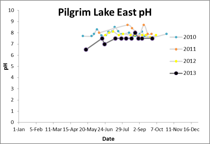
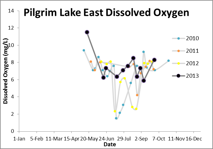
Water Quality Data: Pilgrim Lake East 2010-2013: Pilgrim Lake East |
|
|
|
|
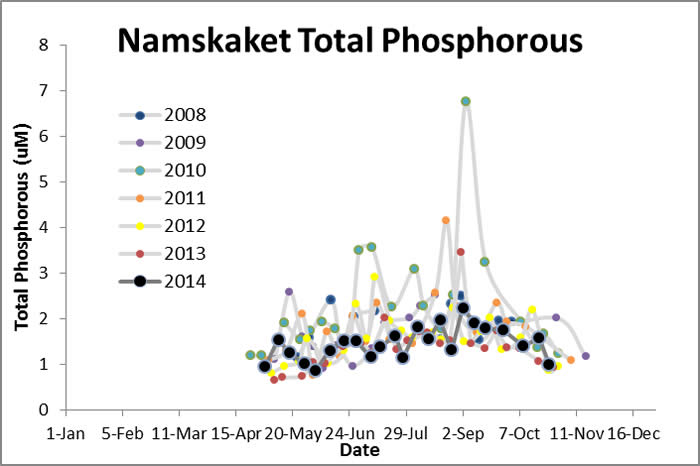
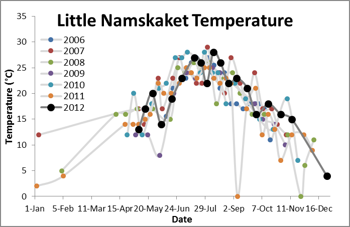
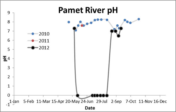
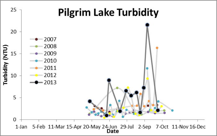
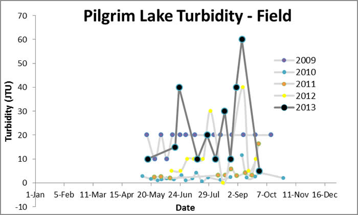
Water Quality: Pilgrim Lake


|
|
|
|
|
 |
 |
 |
 |
 |
 |
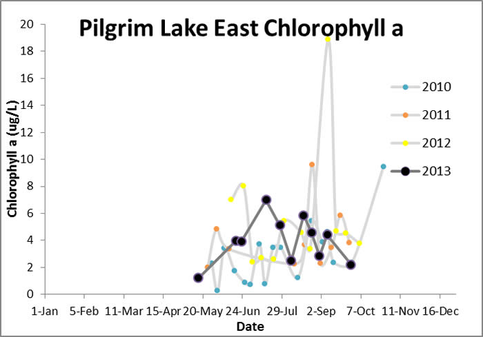
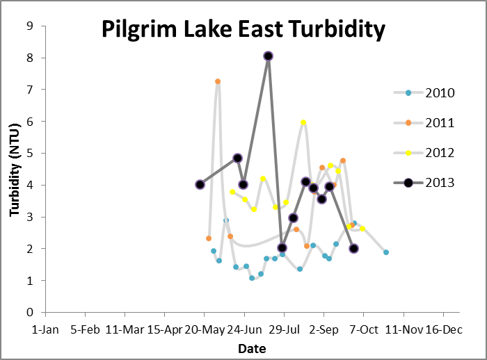
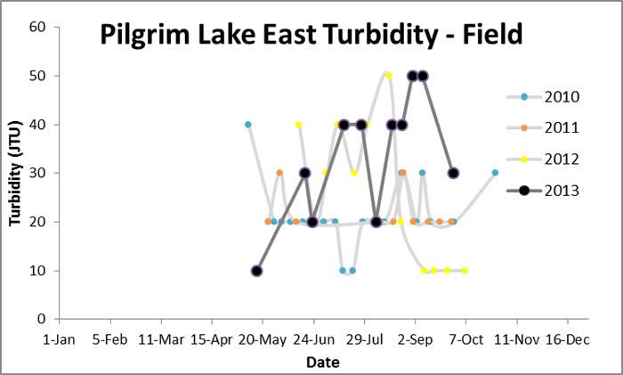
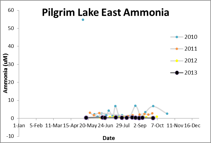
Water Quality: Pilgrim Lake East |
 |
 |
 |
 |
 |
 |
| |
 |
| |
 |
| |
 |
| |
 |
| |
 |
| |
 |
| |