 Geographic Location: 42 05.39 | 70 56.22 Geographic Location: 42 05.39 | 70 56.22
Current Volunteer Monitor: Val Magor
Site Description:
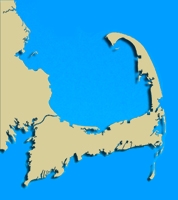
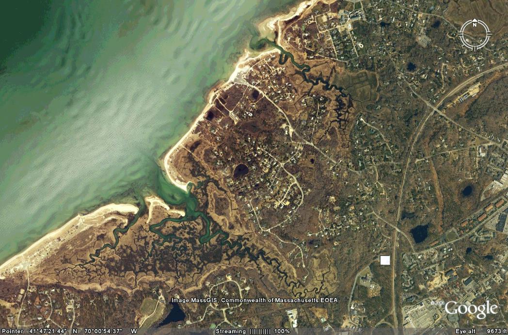
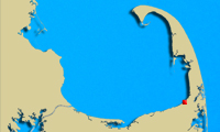
Namskaket Creek is fed by the Namskaket Creek Subwatershed, located in Brewster and Orleans. Although there are both commercial and residential development in some areas within this watershed, most of the area is dominated by Nickerson State Park. Of particular interest with respect to water quality monitoring of this site is discharge of the Tri-Town Septage Treatment Facility to the groundwater in this subwatershed. Although the plume of treated water is flowing wide of the marsh and not deep enough to have an impact on the drinking water, if it continues on its present path, it will eventually reach the Bay. Namskaket Creek is prohibited to shellfishing and is on the 2006 Massachusetts 303(d) List of Impaired Waterbodies.
|
|
|
|
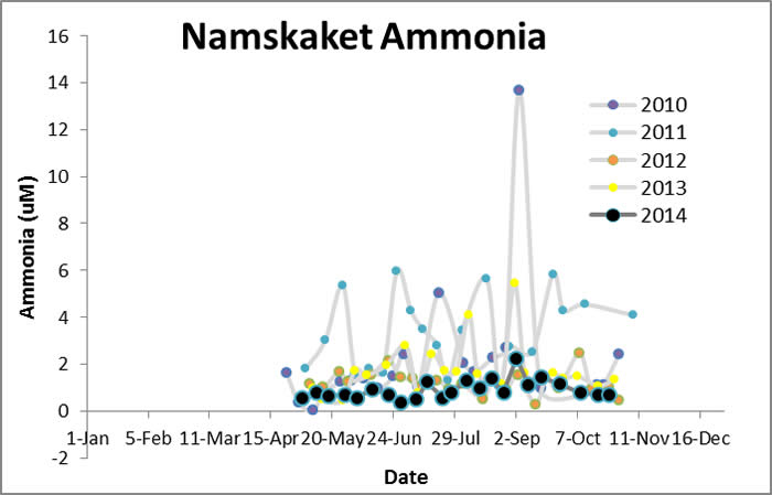
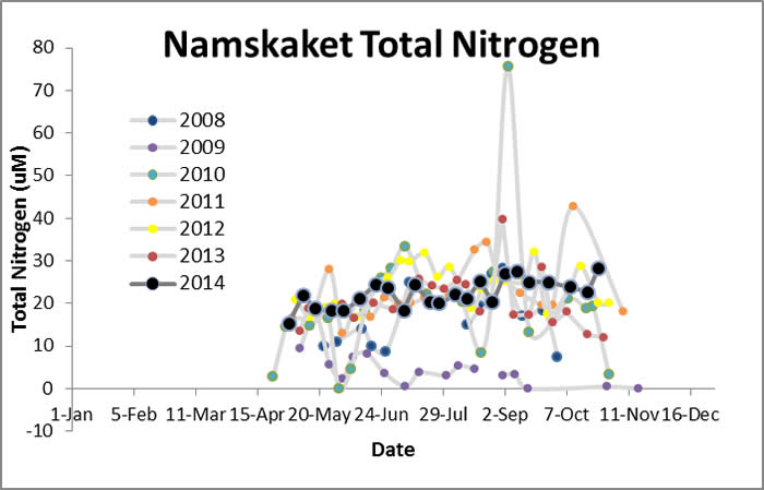
Images:
|
|
|
|
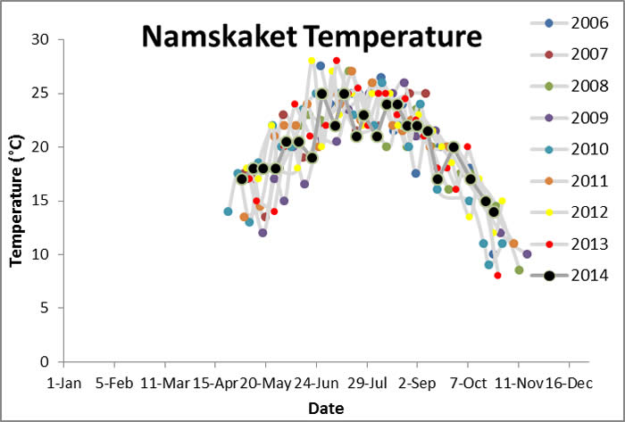
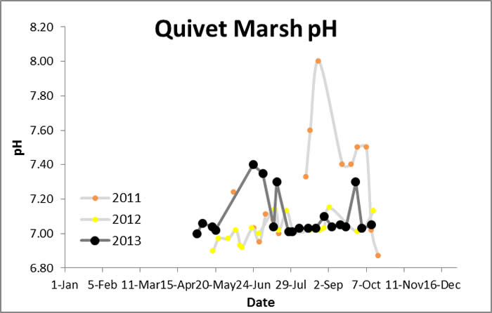
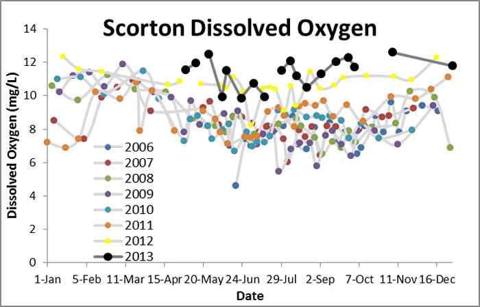
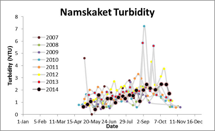
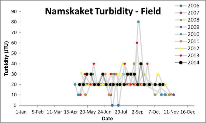
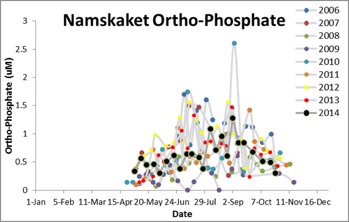
Water Quality Data: Namskaket Creek 2006-2013: Namskaket |
Water Quality:
|
|
|
|
|
| |