 Geographic Location: 42 05.39 | 70 56.22 Geographic Location: 42 05.39 | 70 56.22
Current Volunteer Monitor: REGINA ASMUTIS-SILVA, LEE BURNS
Site Description:
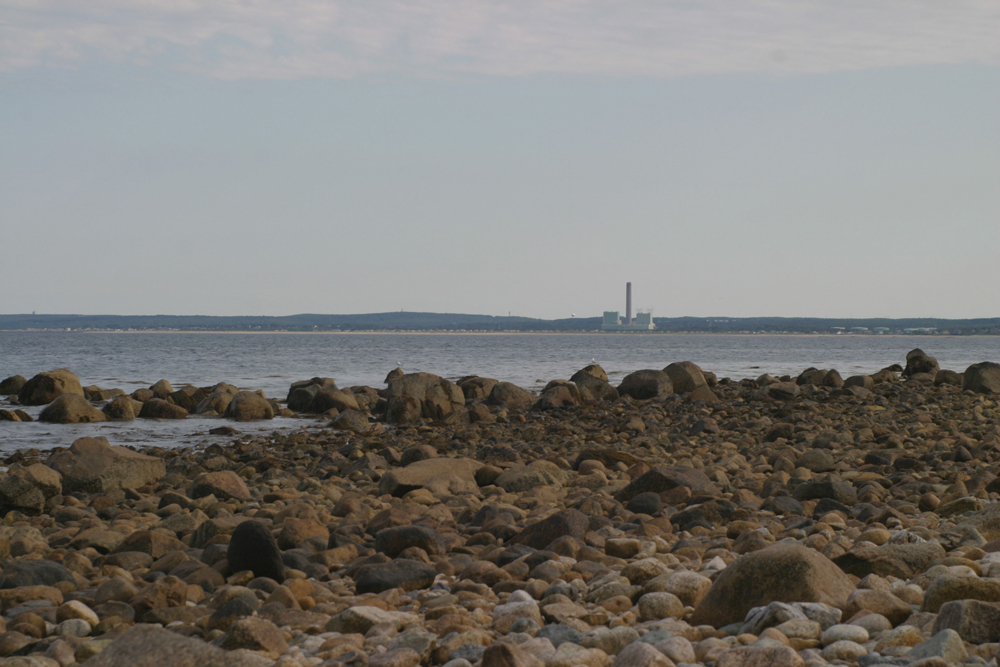
Ellisville Harbor was established as an Area of Critical Environmental Concern (ACEC) in 1980. Nearly 100 acres within this ACEC were acquired by DCR in 1991 as the Ellisville Harbor State Park. Ellisville Harbor is primarily a tidal salt marsh system with an open basin in its lower third and a tidal inlet. Because this inlet is susceptible to occlusion and migration resulting from sediment transport processes, it was reconfigured in 2003 primarily as a means to address the coastal bank erosion (19-29 ft per year) occurring along the west side of the harbor entrance channel (www.appliedcoastal.com/Projects). This has improved the tidal range and circulation within the harbor, adding to the recovery of the salt marsh system. Continued monitoring of this area since the relocation of the inlet will prove to be a valuable way to document changes in the system.
|
|
|
|
|
Images:
|
|
|
|
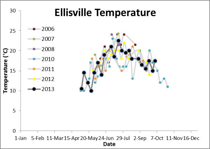
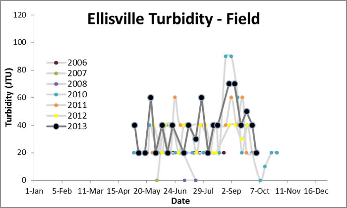
Water Quality Data: Ellisville Harbor 2006-2013: Ellisville
|
|
Water Quality:


|
|
|
|
|

|