Cape Cod Bay
Monitoring
Program

   C I T I Z E N   S C I E N C E

Welcome to the Future of Ecosystem Management

An initiative of the Provincetown Center for Coastal Studies


Threats to the Bay
 
Monitoring Stations Map
 
Citizen Scientists
 
Collaborators & Links
 
Input Data
 

  Monitoring Stations:

  - Provincetown Harbor
  - Pamet River
  - Herring River

  - Pilgrim Lake/Pilgrim Lake

    East

  - North Sunken Meadow

  - Boat Meadow

  - Cole Road Beach
  - Little Namskaket
  - Namskaket

  - Upper Namskaket
  - Paines Creek
  - Grays Beach
  - Barnstable Harbor
  - Scorton Harbor
  - Upper Scorton Creek
  - Old Harbor (Sandwich)
  - Upper Old Harbor Creek
  - Ellisville Harbor
  - Plymouth Harbor
  - Jones River

  - Quivet Marsh

  - Duck Creek (Wellfleet)

  - Sesuit Harbor

  - Millway Beach

 - References


STATION: JONES RIVER
last updated 04.01.2014


Jones River locationGeographic Location:
  42 05.39  |  70 56.22

Current Volunteer Monitor: TIFFANY DAVENPORT

Site Description:

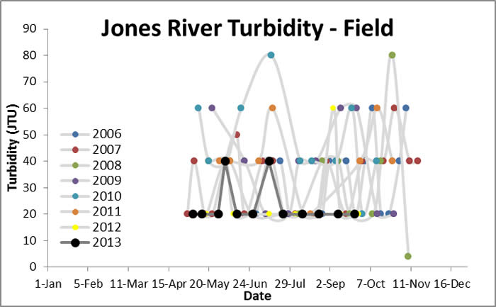
The Jones River is the largest river that empties into Cape Cod Bay. It runs from Silver Lake to Kingston Bay. The Jones River is approximately 8 fluid miles; the watershed area covers 30 square miles. This river is one of the most polluted rivers that drains into the Bay due in part to run-off from lawn and agricultural chemicals, restriction of flushing by dams, and reduced flow from the diversion of water for the Brockton water supply and irrigation. For more information, visit the Jones River Landing website (www.jonesriver.org).

Images:

Jones River Jones River


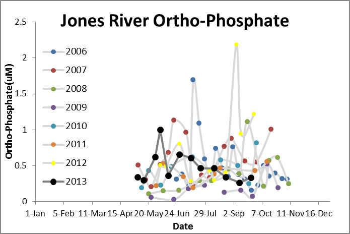
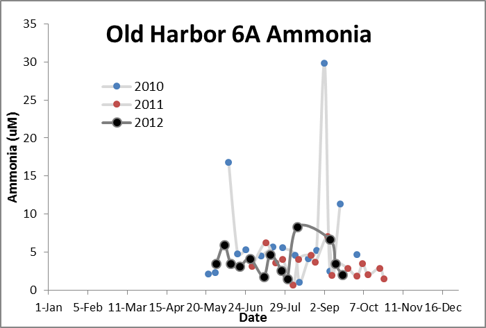
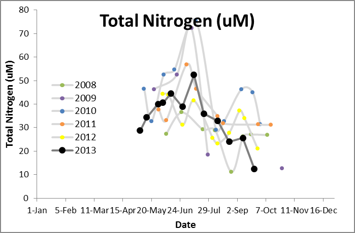
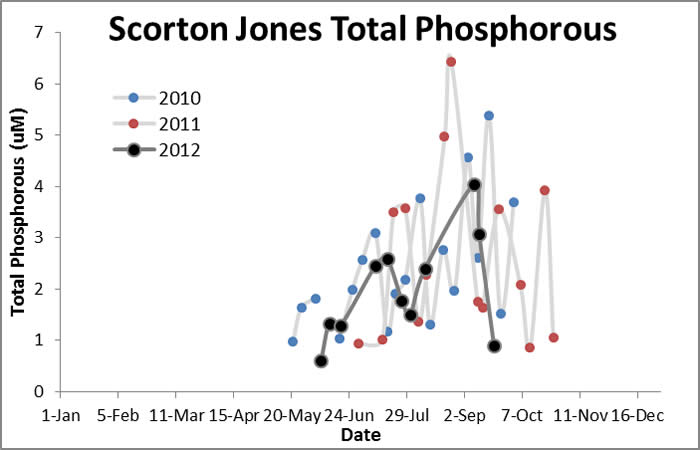
Water Quality Data: Jones River 2006-2013: Jones River


Water Quality:


CONTACT

CITIZEN SCIENTIST HOMEPAGE