Herring River Restoration Project
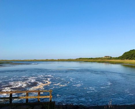
The Herring River at the Chequessett Neck Dike in Wellfleet, MA.
The Herring River Restoration Project broke ground in spring 2023, with plans to restore the 1,100-acre estuary that opens into Wellfleet Harbor, MA. The removal of the tidally-restrictive structures installed in the early 20th century is expected to reestablish hundreds of acres of intertidal salt marsh, in turn promoting associated ecological functions. The restoration project will increase tidal flushing and reduce the ~90 acres of shellfish harvest area downstream that is currently closed seasonally or permanently due to contaminated discharge from the restricted Herring River. Given the importance of shellfishing to the economy and culture of Wellfleet, the Land-Sea Interaction Program is monitoring changes in the sediment transport dynamics and related water quality parameters in the harbor. Learn more about our monitoring techniques below.
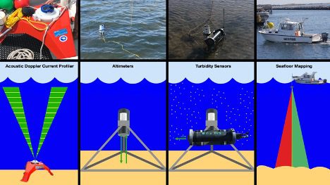
An Acoustic Doppler Current Profiler (ADCP) is deployed near-continuously in Wellfleet Harbor to record waves and currents. The ADCP measures water velocity using sound. The ADCP sits on the seafloor and sends up sound waves. It measures the change in frequency when the sound waves are reflected back from particles in the water to give us accurate measurements of currents throughout the water column and waves at the water’s surface.
Altimeters are deployed near-continuously in Wellfleet Harbor near shellfish beds. Altimeters work using sonar. To work, sound pings are sent from the instrument to the bottom of the seabed, the device listens to the sound waves come back, and then it calculates the distance of the altimeter from the bottom. This gives us a high-resolution picture of bed transport; erosion and deposition at the shellfish beds, where we are most interested in learning about any changes in sedimentation and developing a baseline for what is normal variability and what isn’t.
In conjunction with USGS, turbidity sensors are used to monitor suspended sediment, the sediment that floats in the water column. Turbidity is a measure of the cloudiness of a fluid due to the amount of particles in it. The turbidity sensor sends out a light pulse and then measures the optical radiation that is reflected back by the particles in the water.
Seafloor mapping is conducted regularly throughout the entire harbor, using a variety of techniques detailed here. This allows us to track longer-term changes across a greater geographic area.

