Aerial Surveying
Unmanned aerial systems (UAS) are remotely piloted aircraft colloquially known as drones. These surveying platforms have the ability to carry sophisticated sensors that map earth’s surface in fine scale resolution and in multiple spectral bands. Two-dimensional images collected with a digital camera from the UAS can be transformed into fine scale 3D surface elevation models via a process called Structure-from-Motion (SfM) and are used to study the coastal processes by mapping topographic change over time. Multispectral cameras measure the spectral properties of features and are used to study the abundance and health of important coastal vegetation communities.
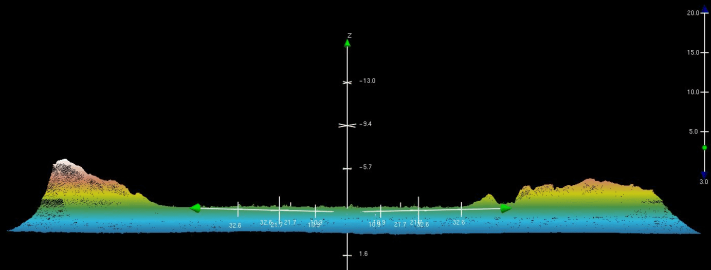
Structure-from-Motion (SfM) is a 3D photogrammetry technology that allows for the rapid collection of data from targets of interest in the field. Using a series of still images with overlap, pixels are matched and the 3D geometry is created. With the ability to create a 3D models with resolutions as low 1 mm, we have modeled everything from large marine animals prior to necropsy, oyster reefs, coral reefs on scuba, and large scale coastal features such as dunes.
The Cape Lab primarily uses two UAS platforms to collect our data, the BirdsEyeView FireFLY6 PRO and the DJI Phantom IV PRO.
Below we can see two examples of 3D point clouds generated using SfM from 2D photographs collected during UAS surveys. These photos illustrate the change in a coastal dune after a breach during a storm.


Our Work
Humpback Whale Research
Right Whale Research
Marine Animal Entanglement Response
Marine Geology Department
Water Quality Monitoring Program
Marine Fisheries Research
Seal Research
Shark Research
Marine Education
Interdisciplinary
Marine Debris and Plastics Program
Marine Policy Initiative
Cape Cod Climate Change Collaborative
Publications